mail_outline sales@mediastorehouse.com
1,114 items
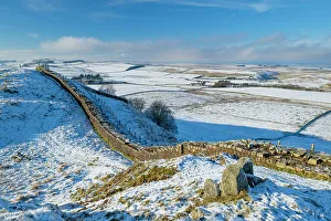
England, Northumberland National Park, Hadrian's WallEngland, Northumberland National Park, Hadrian's Wall. View north of the wall from Caw Gap
England, Northumberland National Park, Hadrian's WallEngland, Northumberland, Northumberland National Park. A well preserved stretch of Hadrian's Wall passing along Caw Gap
England, Northumberland National Park, Hadrian's WallEngland, Northumberland National Park, Hadrian's Wall. Hadrian's Wall snaking over the crags of Steel Rigg with Crag Lough in the distance
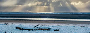
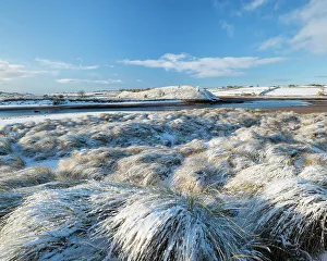
England, Northumberland, Alnmouth. Snow covered beach near the mouth of the Aln Estuary at Alnmouth
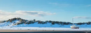
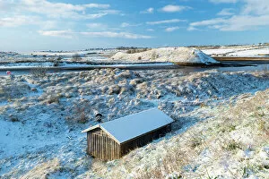
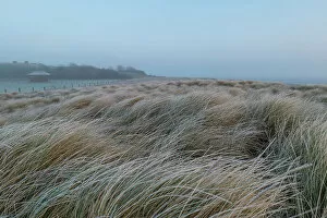
England, Northumberland, Alnmouth. Snow covered sand dunes and boat near the mouth of the Aln Estuary at Alnmouth
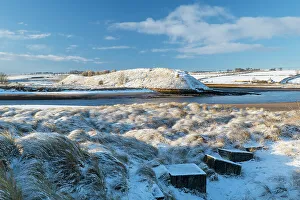
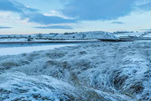
England, Northumberland, Alnmouth. Snow covered sand dunes near the mouth of the Aln Estuary at Alnmouth. The hill in the distance is known as Church Hill
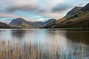
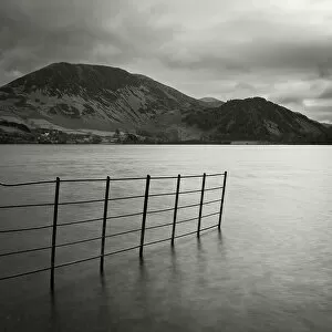
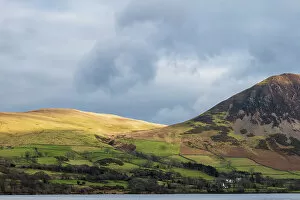
England, Cumbria, Lake District National Park. Buttermere, with Fleetwith Pike in the distance
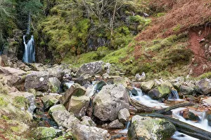
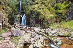
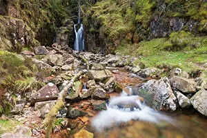
England, Cumbria, Lake District National Park. Scale Force near the village of Buttermere within the Lake District National Park
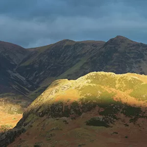
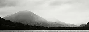
England, Cumbria, Lake District National Park. Breaking light on the mountains near Crummock Water and Buttermere
England, Cumbria, Lake District National Park. Rain clouds engulf the mountain peaks surrounding Loweswater
England, Cumbria, Lake District National Park. Ennerdale Water, a remote lake located in the North-West Lake District
England, Cumbria, Lake District National Park. Mountains surrounding Ennerdale Water, a remote lake located in the North-West Lake District
England, Northumberland, Berwick Upon Tweed. A misty morning on the coast at Berwick Upon Tweed, with the coast line engulfed by fog
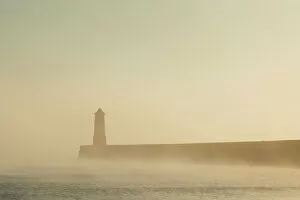
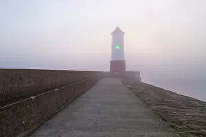
England, Northumberland, Berwick Upon Tweed. A misty morning at Berwick Upon Tweed, with the lighthouse and pier surrounded in fog
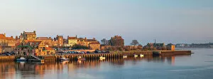
England, Northumberland, Berwick Upon Tweed. Panoramic view of the Quayside at Berwick Upon Tweed viewed at sunset
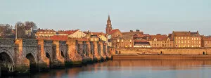
England, Northumberland, Berwick Upon Tweed. Berwick Old Bridge spanning the River Tweed
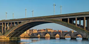
England, Northumberland, Berwick Upon Tweed. Berwick Old Bridge and Royal Tweed Bridge spanning the River Tweed
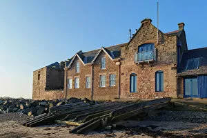
England, Northumberland, Berwick Upon Tweed. The Old Lifeboat House near the quayside and the mouth of the tweed
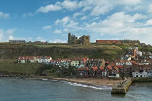
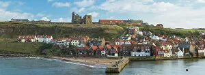
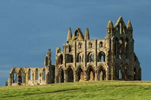
England, North Yorkshire, North York Moors National Park. Whitby Abbey located high above the popular seaside town of Whitby
England, North Yorkshire, North York Moors National Park. The sea defenses of Sandsend, a small fishing village near Whitby
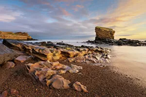
England, Northumberland, Seaton Sluice. Sunrise at Charlies Garden, a rock formation located in Collywell Bay, Seaton Sluice
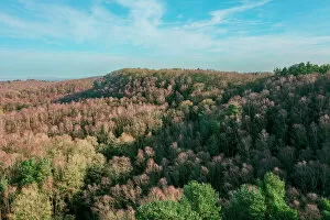
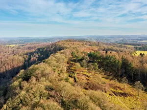
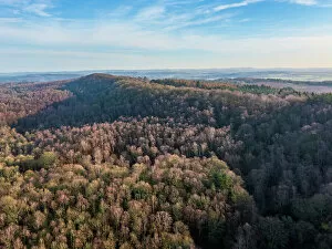
England, West Midlands, Kinver Edge. Aerial view of the sandstone ridge forming Kinver Edge - A popular walking location in Staffordshire
England, West Midlands, Kinver Edge. Aerial view of Vale's Rock and the sandstone ridge forming Kinver Edge - A popular walking location in Staffordshire
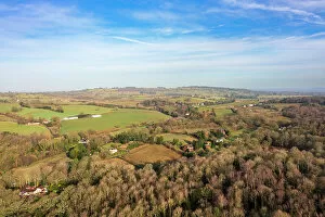
England, West Midlands, Kinver. Aerial view from Kinver Edge - A popular walking location in Staffordshire
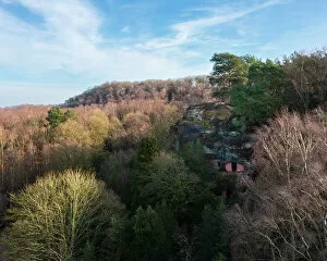
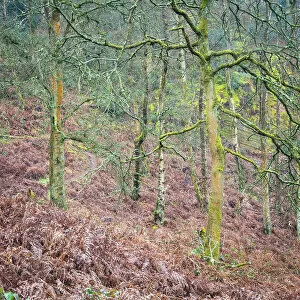
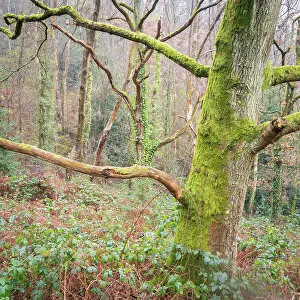
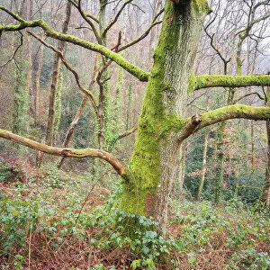
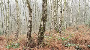
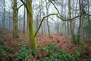
England, West Midlands, Kinver Edge. Pocket of woodland at Kinver Edge, a popular walking location near Stourbridge
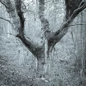
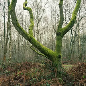
England, West Midlands, Kinver Edge. Abstract view of woodland at Kinver Edge, a popular walking location near Stourbridge
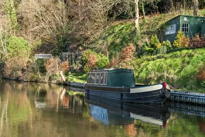
England, West Midlands, Kinver. Narrowboat moored on the Staffordshire and Worcestershire Canal near Kinver
England, West Midlands, Kinver. Detail view of a narrowboat moored on the Staffordshire and Worcestershire Canal near Kinver