mail_outline sales@mediastorehouse.com
1,114 items
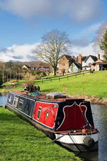
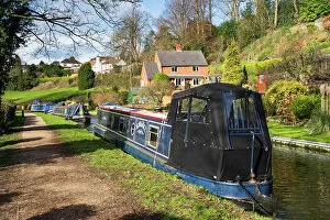
England, West Midlands, Kinver. Detail view of a narrowboat moored on the Staffordshire and Worcestershire Canal near Kinver
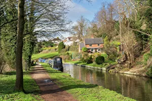
England, West Midlands, Kinver. Narrowboat moored on the Staffordshire and Worcestershire Canal near Kinver
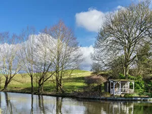
England, West Midlands, Kinver. Summerhouse and trees on the Staffordshire and Worcestershire Canal near Kinver
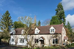
England, West Midlands, Kinver. Stone cottage and trees on the Staffordshire and Worcestershire Canal near Kinver
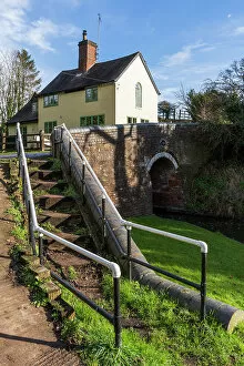
England, West Midlands, Kinver. Stone house and bridge crossing the Staffordshire and Worcestershire Canal near Kinver
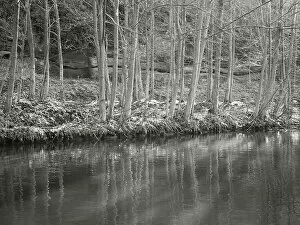
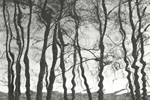
England, West Midlands, Kinver. Riverbank trees reflected on the Staffordshire and Worcestershire Canal near Kinver
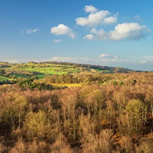
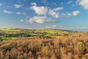
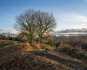
England, West Midlands, Kinver Edge. Pocket of woodland at Kinver Edge, a popular walking location near Stourbridge
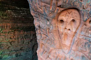
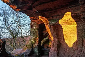
England, West Midlands, Kinver Edge. Carved graffiti in the sandstone walls of the caves in Nannys Rock
England, West Midlands, Kinver Edge. View from the top of Nannys Rock - a popular viewpoint along Kinver Edge
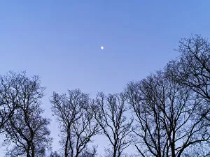
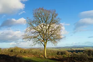
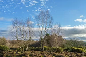
England, West Midlands, Kinver EdgeEngland, West Midlands, Kinver. Trees on the heathland of Kiver Edge - once the location of an Iron Age Hillfort
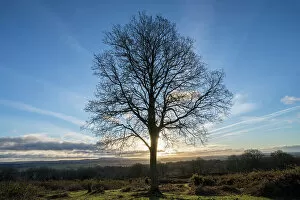
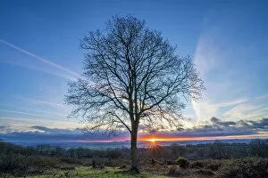
England, West Midlands, Kinver EdgeEngland, West Midlands, Kinver. Tree at sunrise on the heathland of Kiver Edge - once the location of an Iron Age Hillfort
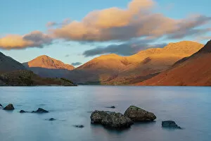
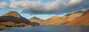
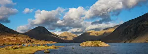
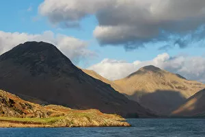
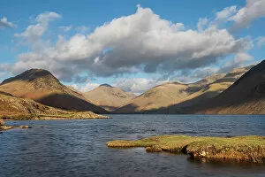
England, Cumbria, Lake District National Park. After light illuminates the mountains surrouding Wasdale, viewed from Wastwater - The deepest lake in England
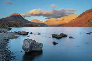
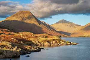
England, Cumbria, Lake District National Park. After light illuminates Great Gable and the other mountains surrouding Wasdale, viewed from Wastwater - The deepest lake in England
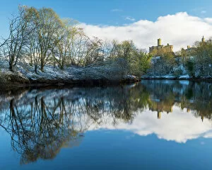
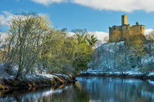
England, Northumberland, Warkworth. Warkworth Castle and surrounding snow covered landscape, reflected upon the still waters of the River Coquet on a winter morning
England, Northumberland, Warkworth CastleEngland, Northumberland, Warkworth. Warkworth Castle and surrounding snow covered landscape, reflected upon the still waters of the River Coquet on a winter morning
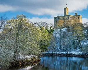
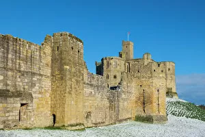
England, Northumberland, Warkworth Castle. Warkworth Castle (English Heritage), a magnificent 12th century stone motte and bailey fortress, and surrounding snow covered landscape on a winter morning
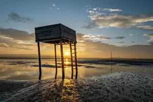
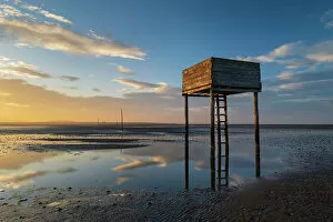
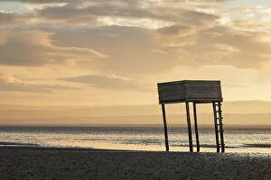
England, Northumberland, Northumberland Heritage Coast. Emergency shelter on the Pilgrim's Causeway linking the Holy Island of Lindisfarne off the Northumberland Coast with the mainland
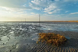
England, Northumberland, Northumberland Heritage Coast. Wooden posts marking the Pilgrim's Causeway linking the Holy Island of Lindisfarne off the Northumberland Coast with the mainland
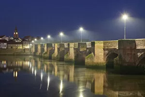
England, Northumberland, Berwick Upon Tweed. Evening scene of Berwick Old Bridge Bridge spanning the River Tweed
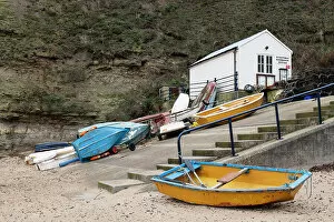
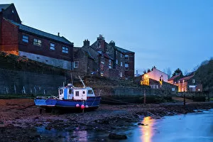
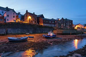
England, North Yorkshire, North York Moors National Park. Early morning light at Staithes Harbour Office, located near the coastal village in the North York Moors National Park
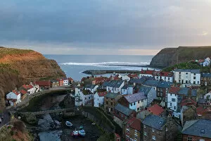
England, North Yorkshire, North York Moors National Park. Early morning light at Staithes, a coastal village in the North York Moors National Park
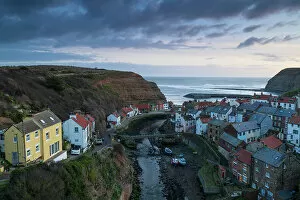
England, North Yorkshire, North York Moors National Park. Pre dawn light at Staithes, a coastal village in the North York Moors National Park
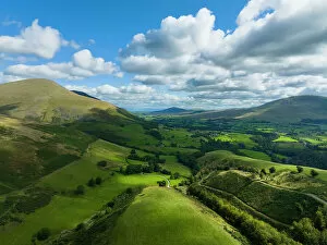
England, Cumbria, Lake District National Park. Aerial view from near the summit of Latrigg looking towards the north east lake district
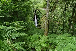
England, Cumbria, Lake District National Park. Aira Force is a powerful body of water near the shores of Ullswater. A circular walk follows both sides of the falls with a picturesque stone bridge
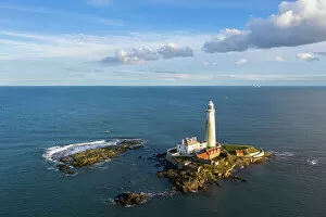
England, Tyne and Wear, Whitley Bay. Aerial view of St Mary's Lighthouse and Island and the North Sea